Nationwide Service | Houston Headquarters

ENTERPRISE EXISTING CONDITION DOCUMENTATION
As-Built Drawings & CAD for Accurate Existing Condition Documentation
Use Reality IMT’s Building Measurement and Existing Condition Documentation services to create accurate CAD floor plans, building layouts, and as-built drawings from verified field measurements. Our team supports architects, engineers, owners, facility managers, and contractors with dependable documentation for renovation, planning, and facility management.
What This Service Includes
Our Building Measurement Services transform existing facilities into accurate CAD documentation and as-built drawings that support planning, renovation, facility operations, and design workflows.
Existing condition site measurement
Accurate floor plan development
CAD and DWG production
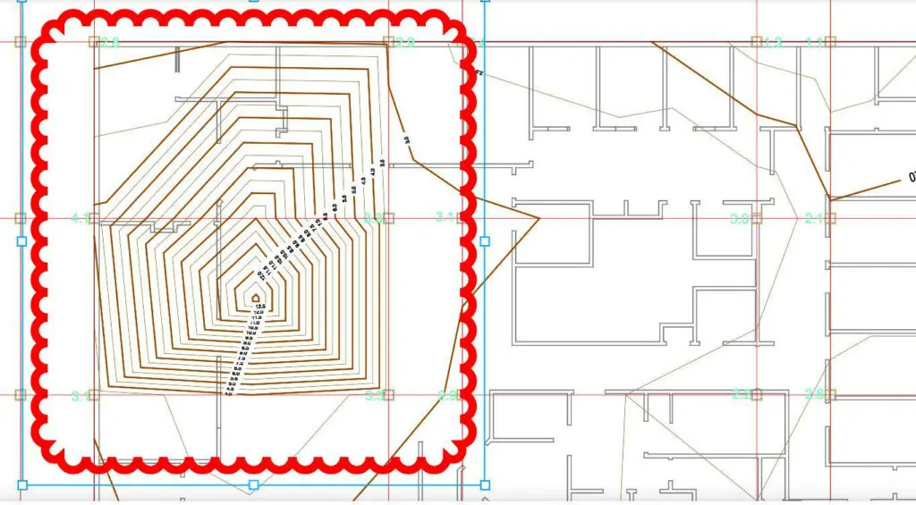
Building area verification
Existing-condition documentation
Facility record documentation
Renovation planning support
Documentation for architects, engineers, and owners
Who Uses This Service
Architects & Design Teams
Accurate floor plans, elevations, and existing-condition documentation for renovation and retrofit projects.
Building Owners & Facility Managers
Reliable as-built records for maintenance, space planning, lease management, and future upgrades.
Engineers & Consultants
Field-verified CAD drawings that support MEP, structural, and engineering workflows.
Commercial Real Estate Professionals
Existing-condition documentation for tenant improvements, acquisitions, and property assessments.
Common Use Cases
Accurate Existing-Condition Documentation
Create dependable CAD drawings from field measurements and laser scanning data.
Renovation & Retrofit Planning
Support design and construction projects with verified building information.
Space Verification & Lease Planning
Document rentable and usable areas for property and facility management.
How Existing Conditions Become Deliverables
Deliverables
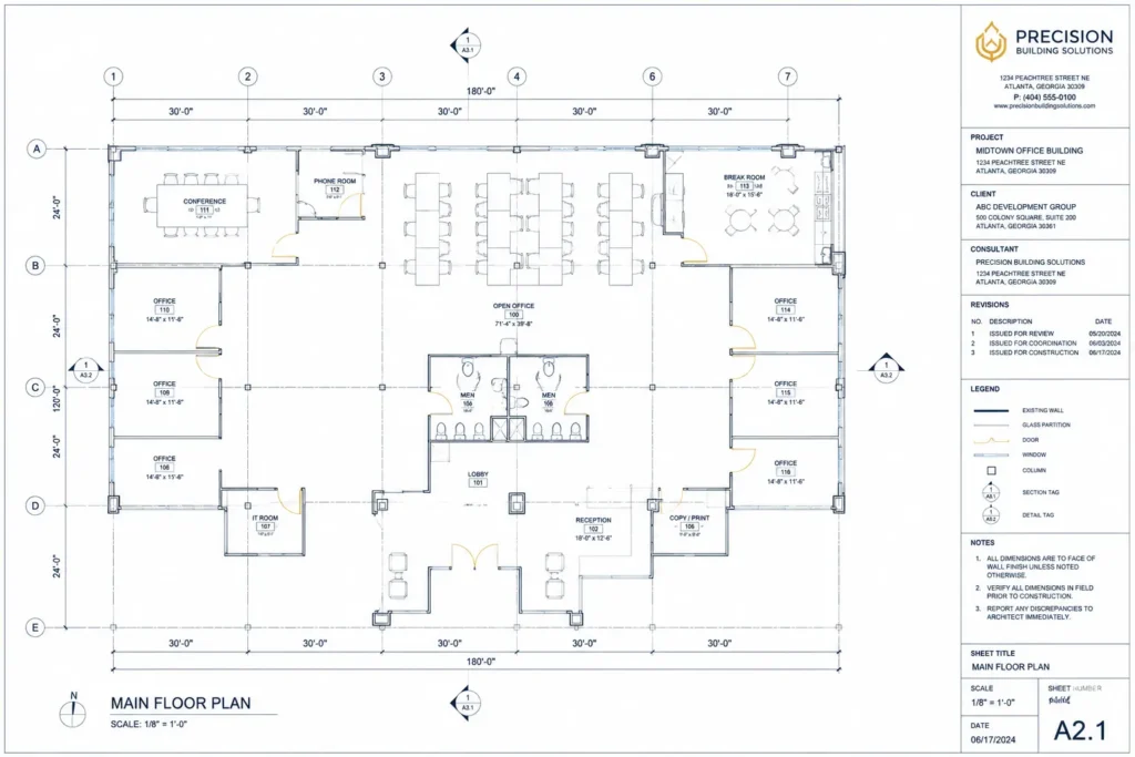
CAD / DWG Floor Plans
2D floor plans suitable for design, engineering, and construction workflows.

Reflected Ceiling Plans
Existing ceiling layouts and overhead building features.
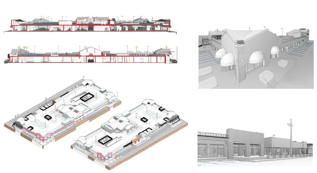
Elevations & Building Sections
Field-verified vertical documentation where required.
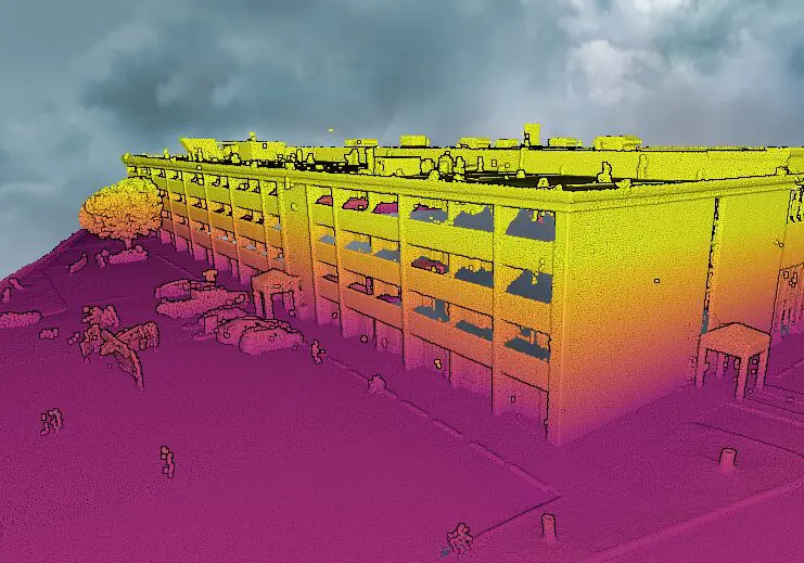
Point Cloud Data
Registered point cloud files for advanced modeling and documentation workflows.
PDF Documentation Packages
Organized drawing sets ready for review, planning, and project execution.
Our Process
1
Site Measurement & Data Capture
Collect building measurements using laser scanning and conventional field verification methods.
2
CAD Production & Quality Review
Convert captured data into accurate floor plans, elevations, and documentation deliverables.
3
Final Delivery
Provide CAD, DWG, PDF, and supporting files based on project requirements.
See a Real Facility Walkthrough
FAQs
What are as-built drawings?
As-built drawings document the actual existing conditions of a building after construction or based on current field measurements.
How accurate are your building measurements?
Accuracy depends on project scope and capture method, but laser scanning enables highly detailed existing-condition documentation.
Do you provide DWG and CAD files?
Yes. Deliverables can include DWG, CAD, PDF, and other requested formats.
Can you document occupied facilities?
Yes. Most projects can be completed with minimal disruption to daily operations.
Do you offer nationwide service?
Yes. Reality IMT supports projects across the United States.
Can the drawings be used for renovation projects?
Yes. Existing-condition drawings are commonly used for renovation, retrofit, and facility planning projects.
Do you provide point cloud data?
Yes. Registered point cloud deliverables are available when included in the project scope.
Can you create Revit models from the captured data?
Yes. Scan-to-BIM and Revit modeling services are available as related services.
How long does a typical project take?
Project timelines depend on facility size, complexity, and required deliverables.
How do I request a quote?
Contact our team with project location, approximate size, and required deliverables.
Proven As-Built Drawings & CAD Projects
These As-Built Drawings & CAD projects showcase how Reality IMT transforms accurate field data into detailed existing-condition documentation for architects, engineers, contractors, and property owners. From commercial buildings and industrial facilities to healthcare, hospitality, retail, and residential properties, our deliverables include precise AutoCAD drawings, floor plans, elevations, reflected ceiling plans, and Revit models that support renovations, tenant improvements, facility management, and capital planning.
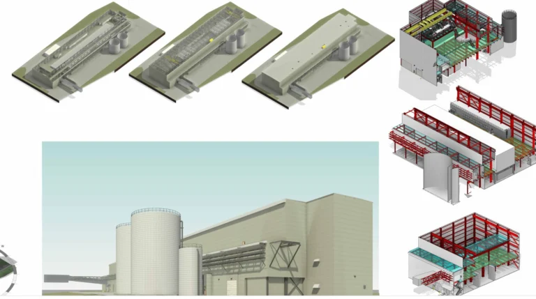
10 Sep 2025
Lufkin Power Facility Existing-Condition Documentation
Reality IMT provided industrial 3d laser scanning for this power facility totaling approximately 367,000 SF…
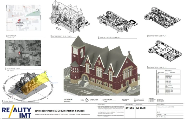
13 Jan 2025
Town of Amherst Municipal Building Documentation
Reality IMT provided building documentation for this municipal building portfolio totaling approximately 238,000 SF in…
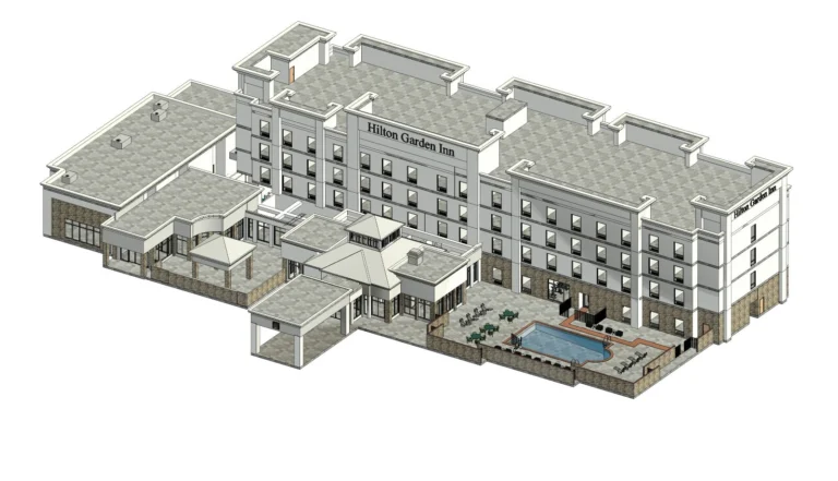
11 Apr 2022
Hilton Garden Inn Hotel Renovation Documentation
Reality IMT provided hotel renovation documentation for this hotel totaling approximately 137,000 SF in San…
Need accurate as-built drawings for your project?
Send your project location, approximate building size, and required deliverables to receive a customized quote.