ENTERPRISE STREET & CORRIDOR MAPPING
Mobile LiDAR & Street Mapping Services for Roadways, Corridors and Asset Documentation
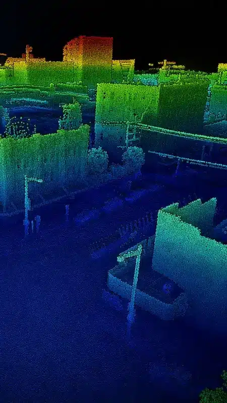
Reality IMT captures roadway and corridor conditions using mobile LiDAR, street-level imagery, GNSS/INS positioning, and GIS-ready asset data for infrastructure projects nationwide.
Digital Right-of-Way Documentation for Planning, Engineering and Asset Management
Reality IMT provides nationwide mobile LiDAR mapping services for roadways, corridors, municipal rights-of-way, campuses, utility routes, and other infrastructure documentation projects.
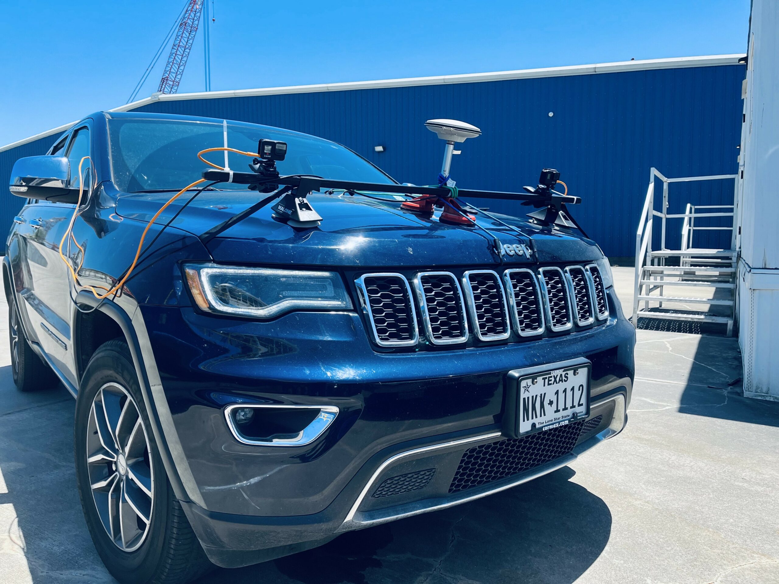
Using mobile LiDAR, GNSS/INS positioning, and high-resolution street-level imagery, our vehicle-based workflow efficiently captures long routes, distributed assets, and complex outdoor environments.
Project deliverables may include registered point clouds, roadway and asset inventories, CAD or Civil 3D base mapping, GIS-ready features, 360 imagery, video logs, and mapping reports tailored to the project scope.
Best Fit Projects
- Roadway and corridor asset inventory
- Municipal right-of-way documentation
- Utility corridor mapping support
- Campus road and parking infrastructure
- Industrial site roadway documentation
- GIS database updates and visual records
Common Street Mapping Applications
Roadway Asset Inventory
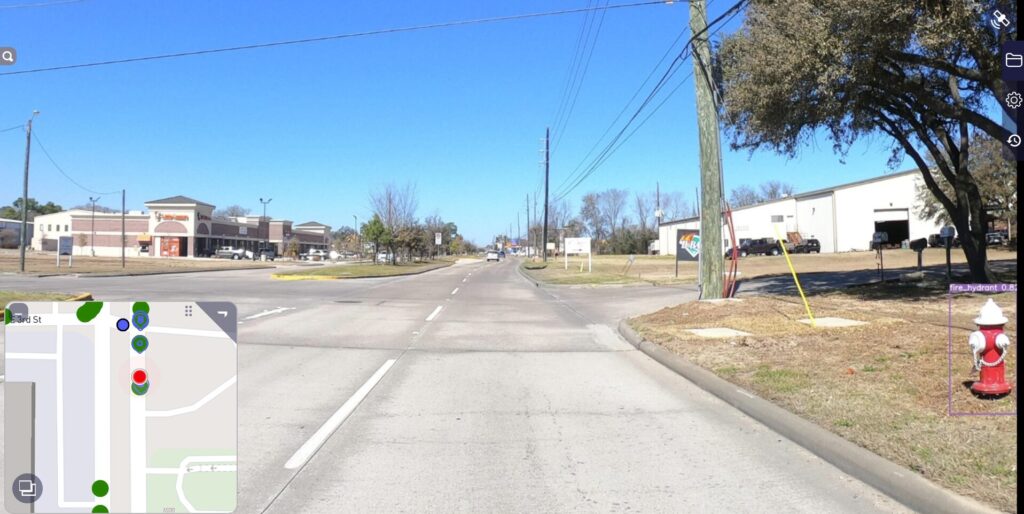
Document signs, pavement markings, inlets, visible utilities, signals, poles, streetscape features, and other required roadway assets.
GIS and CAD Mapping
Prepare GIS-ready point, line, and polygon features, CAD base mapping, Civil 3D support files, and asset tables for internal workflows.
Remote Corridor Review
Use 360 photos or video logs to review field conditions remotely and reduce repeated site visits during planning or coordination.
Pre-Construction Documentation
Create a reliable existing-condition record before construction, utility work, roadway improvements, or site redevelopment begins.
Public Works Planning
Support roadway maintenance, planning, safety reviews, infrastructure records, and right-of-way improvement programs.
Campus & Private-Site Mapping
Map private roads, parking areas, industrial facilities, institutional campuses, and other large outdoor environments.
Who Uses Mobile LiDAR and Street Mapping Services?
These services are designed for organizations that need reliable existing-condition data across roadways, corridors, campuses, utility routes, or distributed outdoor assets.
- City planners and public works teams — roadway conditions, asset inventory, and planning support
- Civil engineers — design basemaps, corridor documentation, and visible feature extraction
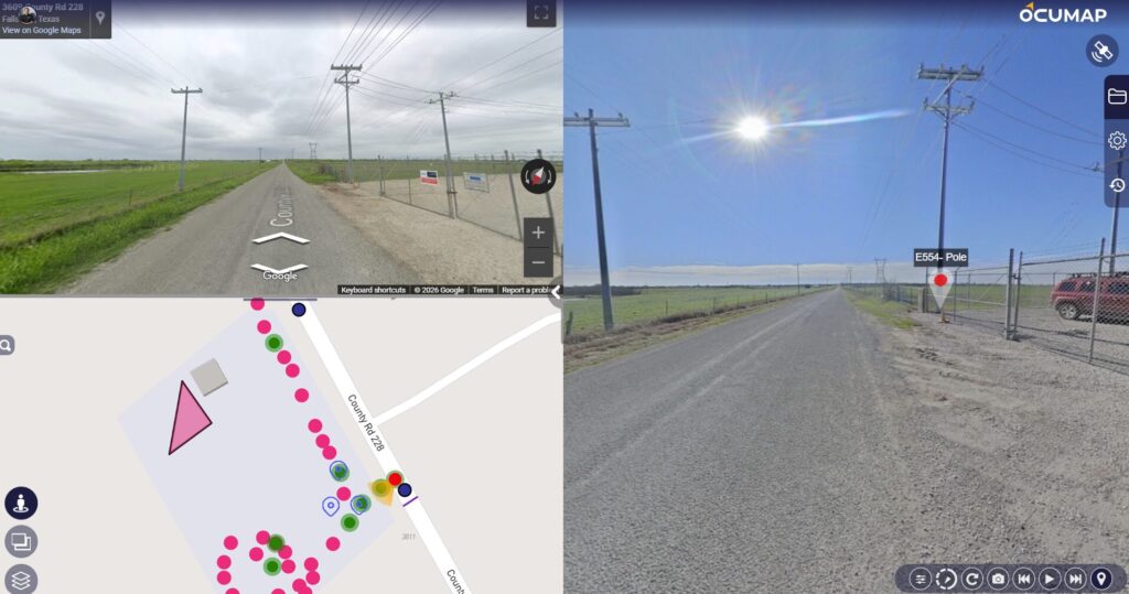
- Utility project managers — pole lines, overhead utilities, inlets, access routes, and visible infrastructure
- Construction managers — pre-construction documentation, progress reference, and closeout records
- GIS professionals — GIS-ready asset data, shapefiles, geodatabases, and location-based records
- Owners and facility teams — campus roads, parking areas, industrial sites, and private infrastructure
Street Mapping Technology
Reality IMT uses a combination of field capture and geospatial processing tools to document roadway and corridor environments efficiently.
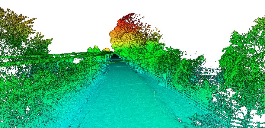
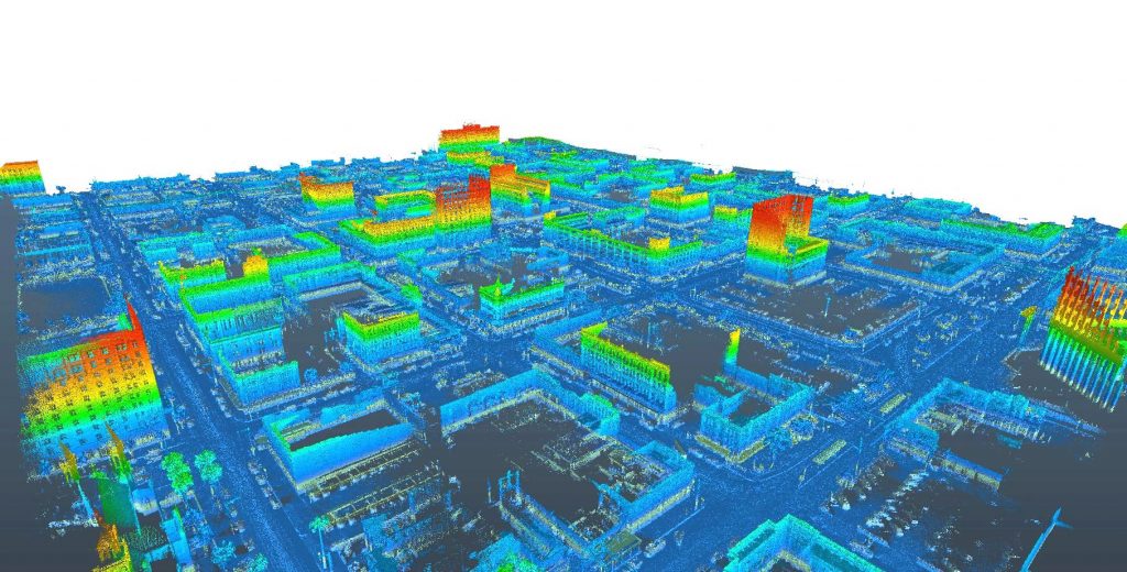
Mobile LiDAR
Dense 3D point cloud capture for roadway, corridor, and right-of-way environments.
GNSS / INS Positioning
Georeferenced trajectory and mapping control to support location-based deliverables.
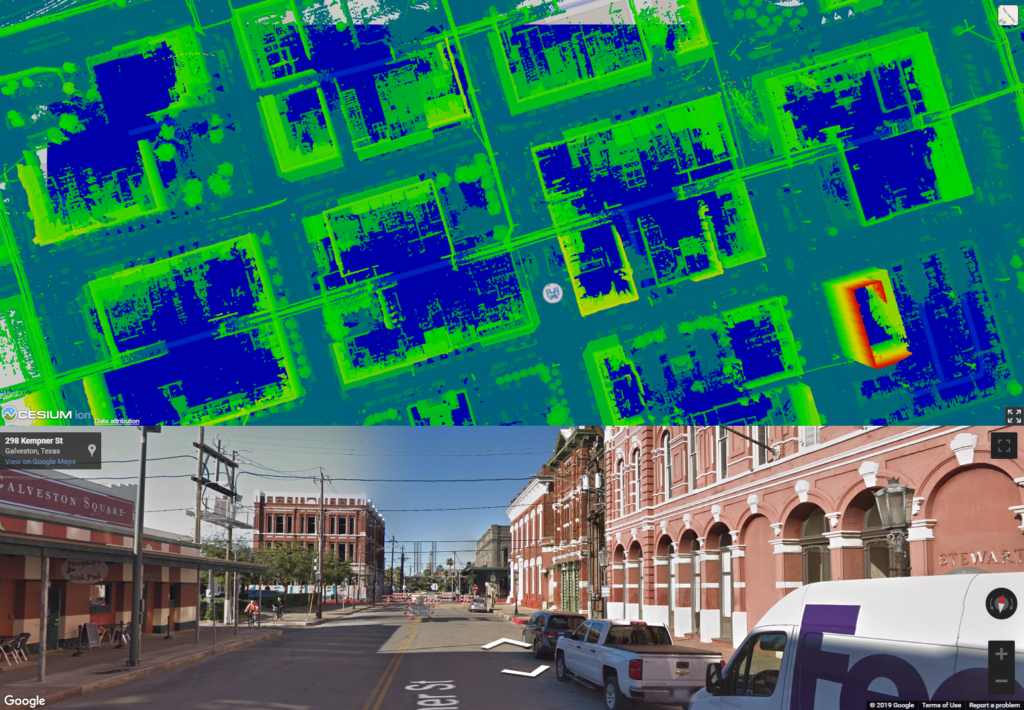
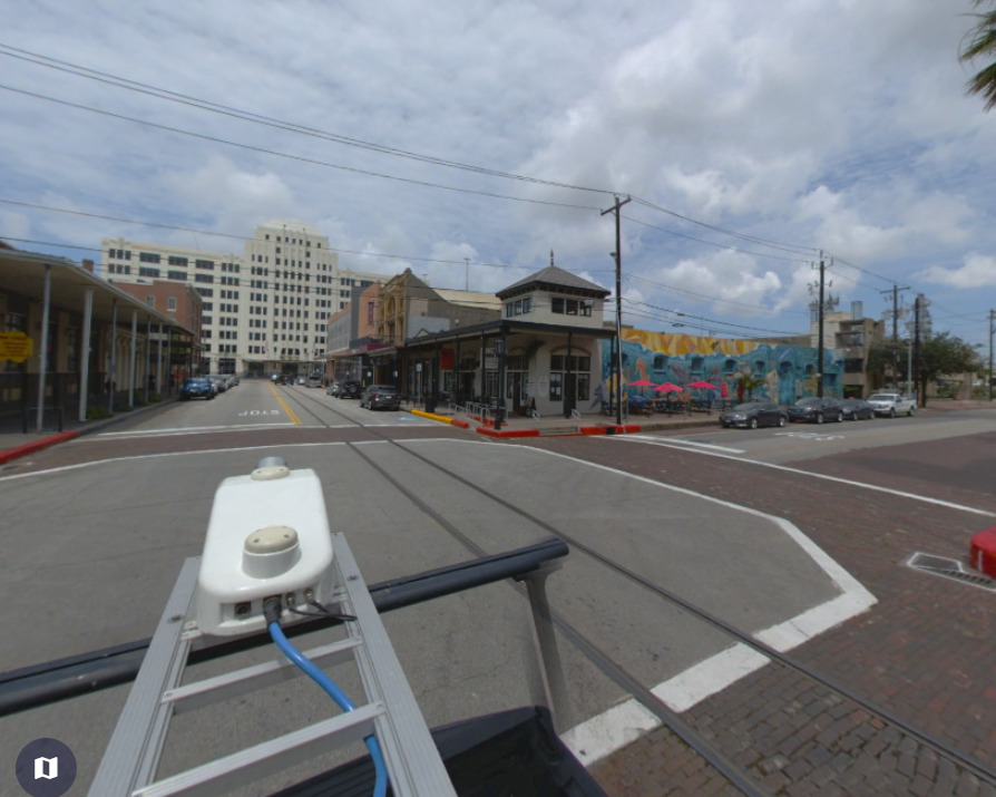
Street-Level Imagery
High-resolution photos, 360 imagery, or video logs for visual reference and asset review.
Photogrammetry
Supplemental image-based workflows when appropriate for the required mapping scope.

Feature Extraction
Extraction of points, lines, polygons, CAD layers, GIS features, and asset records.
Processing & QA/QC
Processing, alignment, and review steps before final deliverables are issued.
Street Mapping Deliverables
Depending on project scope, Reality IMT can provide roadway and right-of-way documentation that may include:
Point Clouds & Mapping Data
- Mobile LiDAR point clouds
- Vertical alignment reference data
- Roadway and corridor base mapping
- CAD or Civil 3D base mapping support
Asset Inventory
- Roadway and corridor asset inventory
- Sign inventory and MUTCD-based asset coding
- Pavement markings and lane features
- Traffic signals and visible signal assets
- Drainage inlet locations
- Visible overhead utilities and sag line reference
- Streetscape and landscape area documentation
GIS Deliverables
- GIS-ready point, line, and polygon features
- Geodatabases or shapefiles
- Asset tables and attribute records
- GIS database updates
Visual Documentation & Reports
- 360 street-level imagery or video logs
- Hosted visual review
- Project mapping reports and summaries
- Project documentation packages
Scope Note
Street mapping deliverables are customized by project. Reality IMT can provide mapping, asset inventory, point cloud, imagery, GIS, and CAD support. Certified survey, sealed engineering analysis, or formal pavement engineering ratings should be scoped separately when required.
Need help defining the right mapping deliverables?
Send us the route limits, approximate length, required assets, and preferred CAD, GIS, imagery, or point cloud formats.
Delivery Formats
Reality IMT can prepare deliverables in formats that fit your existing workflow.
- GIS formats — geodatabase, shapefile, or GIS-ready asset tables
- CAD formats — AutoCAD DWG or Civil 3D files
- Point cloud formats — E57, LAS, LAZ, or other agreed formats
- Street-level imagery — 360 photos, video logs, or hosted visual review
- Reports and summaries — asset inventory reports, mapping summaries, and project documentation
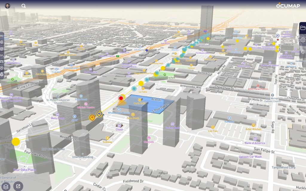
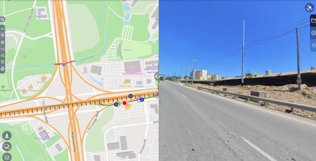
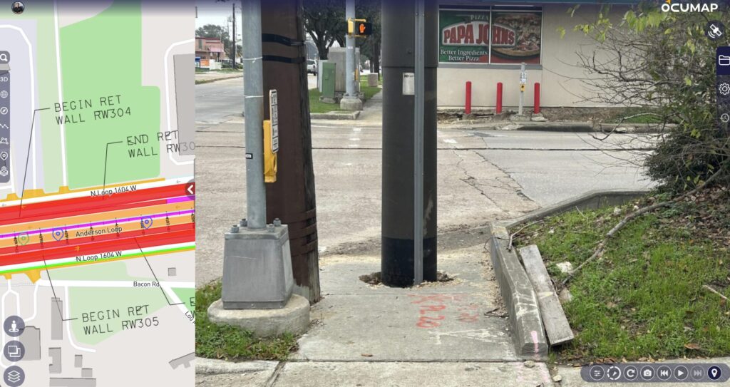
Optional OcuMap Visual Review
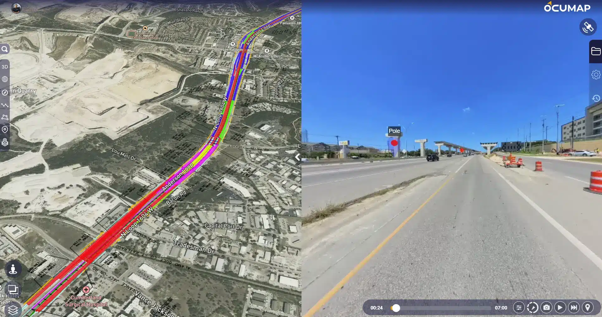
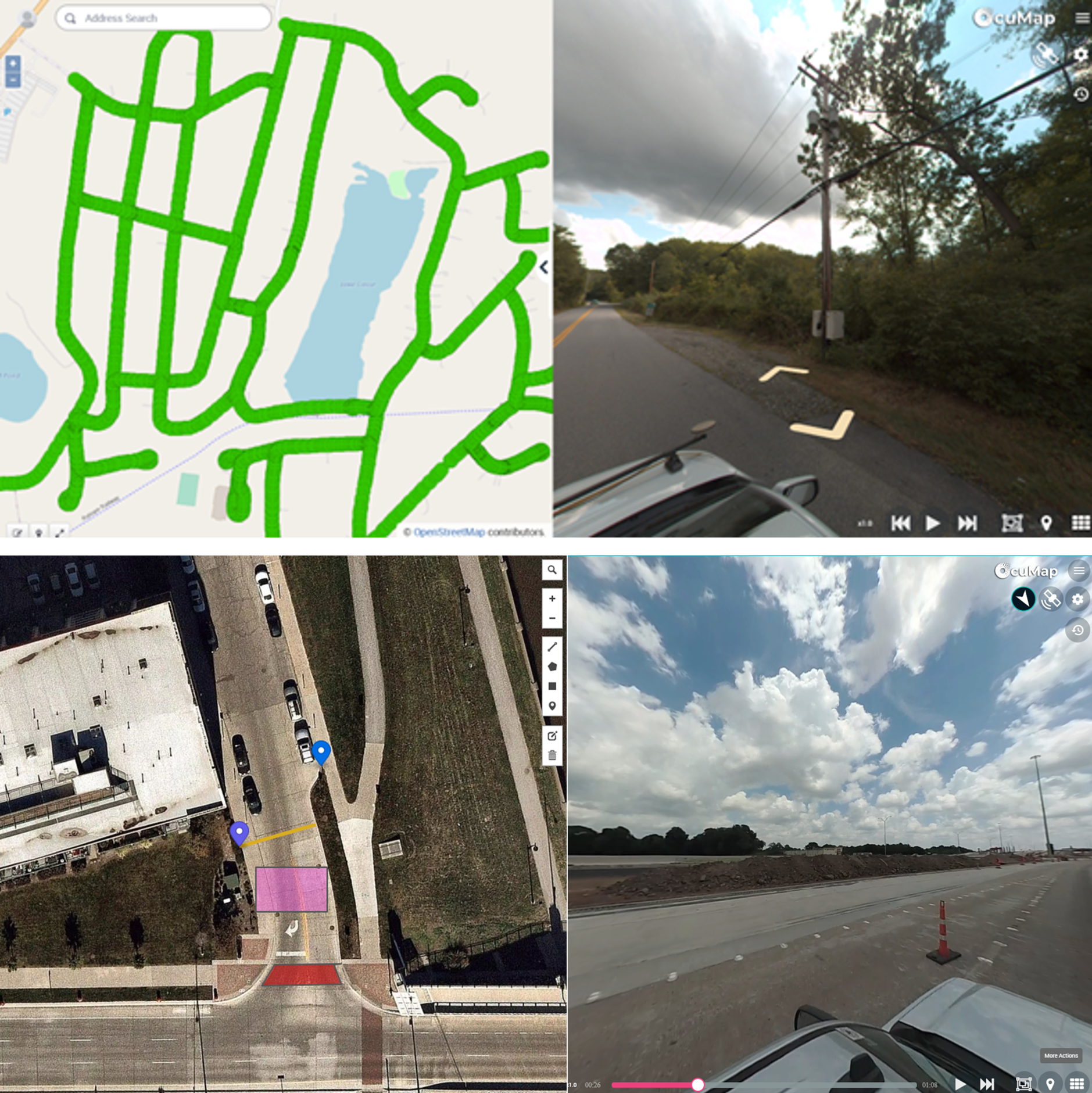
For projects requiring map-based access to roadway imagery or asset documentation, Reality IMT can provide an optional OcuMap visual review environment.
OcuMap can organize street-level imagery, video, mapped assets, observations, and project references along the documented route. This allows project teams to review corridor conditions remotely without relying only on folders of disconnected files.
How the Process Works
Project Review
We review the project limits, route length, required assets, deliverable formats, and access constraints.
Field Data Collection
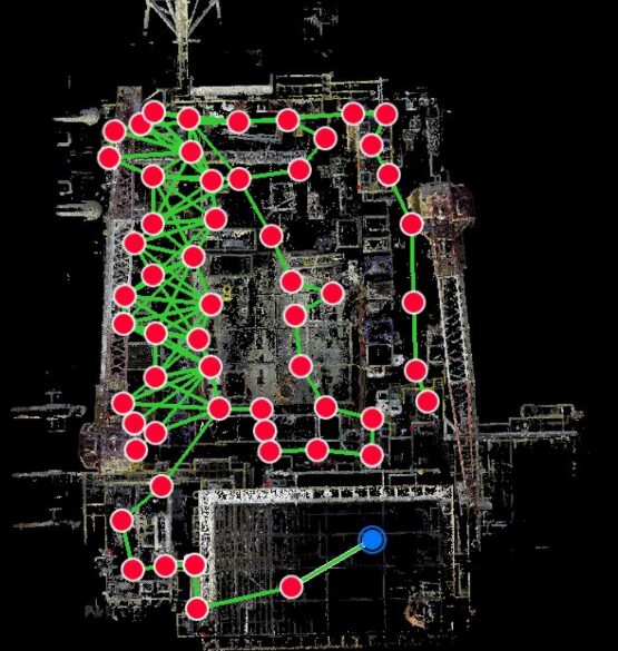
Our team captures LiDAR, imagery, and positioning data from a vehicle-based mapping system.
Processing & Alignment
Data is processed, aligned, reviewed, and prepared for extraction or delivery.
Extraction
Required features are extracted as points, lines, polygons, CAD layers, GIS data, or reports.
Delivery & Documentation
Final deliverables are provided in the agreed formats, such as DWG, Civil 3D, GIS, LAS/LAZ, E57, imagery, or reports.
Why Choose Reality IMT?
Reality IMT combines field capture, geospatial processing, CAD and GIS production, asset extraction, and visual documentation within one coordinated workflow. This reduces handoffs and gives project teams a consistent set of existing-condition records for planning, design, construction, maintenance, and asset management.
One coordinated team manages field capture, geospatial processing, asset extraction, and final CAD, GIS, point cloud, imagery, and reporting deliverables.
- Efficient corridor capture with reduced field disruption
- Coordinated LiDAR, imagery, and GNSS/INS workflows
- Flexible GIS, CAD, Civil 3D, point cloud, and visual deliverables
- Custom asset extraction based on project requirements
- Experience across roadway, rail, municipal, campus, and industrial environments
- Nationwide project deployment from our Houston headquarters
Information Needed for a Quote
To prepare an accurate proposal, please provide:
- Project location or route limits
- Approximate corridor length
- Required assets or features to extract
- Preferred deliverable format
- Accuracy or control requirements, if known
- Traffic control, access, or special scheduling requirements
- Desired timeline
Accuracy, Survey Control and Scope Requirements
Mobile mapping accuracy depends on the required deliverables, GNSS conditions, site environment, route characteristics, control requirements, equipment configuration, and processing workflow.
Reality IMT provides mapping and existing-condition documentation services. When survey-grade control, certified survey deliverables, sealed engineering analysis, or formal pavement condition ratings are required, those requirements must be identified and scoped separately before the project begins.
Street Mapping FAQs
What is street mapping?
Street mapping is the process of capturing roadway, corridor, and right-of-way conditions using mobile LiDAR, imagery, positioning systems, and geospatial processing. The data can support asset inventory, planning, engineering, maintenance, and GIS updates.
Who uses street mapping services?
Common users include city planners, public works teams, civil engineers, utility project managers, construction managers, GIS professionals, campus owners, and facility teams.
What technology is used?
Projects may use mobile LiDAR, GNSS/INS positioning, high-resolution street-level imagery, 360 photos or video logs, photogrammetry, and feature extraction workflows depending on the scope.
What data can Reality IMT extract?
Data may include signs, pavement markings, traffic signals, drainage inlets, visible overhead utilities, sag line reference, streetscape features, pavement condition inventory support, and other agreed roadway assets.
What formats can you deliver?
Deliverables can include E57, LAS, LAZ, DWG, Civil 3D, shapefiles, geodatabases, asset tables, 360 imagery, video logs, and project reports depending on the agreed scope.
How long does a street mapping project take?
Timeline depends on corridor length, asset extraction scope, deliverable requirements, control requirements, access conditions, and QA/QC needs. Smaller projects can often be turned around quickly, while larger corridors require additional processing and review.
Can deliverables be customized?
Yes. Reality IMT can tailor asset extraction, CAD layers, GIS attributes, reports, imagery delivery, and point cloud formats to match the project requirements.
Can you provide GIS-ready asset data?
Yes. Reality IMT can prepare GIS-ready point, line, and polygon data, asset tables, shapefiles, or geodatabase deliverables when included in the project scope.
Can you include 360 imagery or video logs?
Yes. Street-level imagery, 360 photos, and 360 video logs can be included for projects that need visual review, remote coordination, or documentation records.
How do I request a quote?
Send the project location, approximate route length, required assets, preferred deliverable format, and timeline. Our team will review the scope and respond with follow-up questions or a proposal.
Request a proposal for street mapping services.
Tell us about your corridor, roadway, site, or asset mapping project. Include the project location, estimated route length, required assets, and preferred deliverable formats.