Mobile Mapping
Street Level LiDAR Data Acquisition and Feature Extraction
Reality Imaging and Mapping Technologies can deliver engineering-grade mobile LiDAR data at travel speed. All you need to do is send us the location and the local coordinate system you’d like pointcloud data delivered in and we’ll take care of the rest. Our Team of Civil Engineers and Geomatics professionals from our 3D laser and mobile LiDAR mapping team have over a decade of experience in collecting Street Level LiDAR and Panoramic Imagery for infrastructure documentation, assessment, and analysis.
We Acquire 3D Geospatial Data From a Moving Vehicle
Let Us Save You the Hassle of Street Surveying and Mapping
Do you need to accurately document your street dimensions and conditions? We’re here to help. Our team is very efficient at collecting large sets of 3D geospatial data for clients nationwide with accuracies up to 1 cm. Need your data delivered in AutoCAD or MicroStation? Not a problem, We’ve been delivering quality street surveys and as-builts using LiDAR since 2015. Our happy and repeating clients span across multiple industries including Engineering, Surveying, Construction, and Local Government.
Right of Way & Corridor Mapping
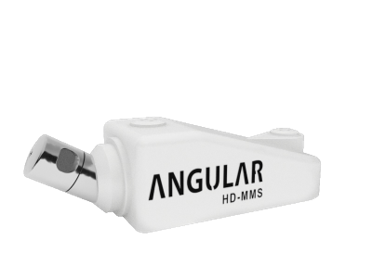
The Mobile LiDAR Mapping range from our company is 100 feet (Radius) with 700,000 measurements/sec
Ideal Solution for Infrastructure Asset Mapping
Urban Planning | Condition Assessment | Smart Cities
Reality IMT can help you perform rapid infrastructure condition assessment using predefined criteria (to be provided by the client or defined per ASTM standards).
We combine GIS, Civil Engineering, and Geomatics expertise to help you confidently locate, measure, and assess infrastructure assets all from your desktop. Once the scope of work and deliverables are identified, we work with your team on prioritizing the areas of interest and developing a GIS network analysis to help us plan field data collection.
Get Flood Elevation Data in Days
High density mobile LiDAR data is collected 5 feet above street surface.
Drive it once, revisit it as many times as you need to.
Safely quantify road material before, during, and after construction. Get a digital footprint of your project site at any moment in time without disrupting operations or traffic.
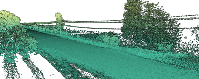
Road LiDAR Survey
DTM or DSM contours every 6 inches and can be delivered showing the centerline of the road, road markings, curb inlets, manholes, ditches, and more depending on the scope.

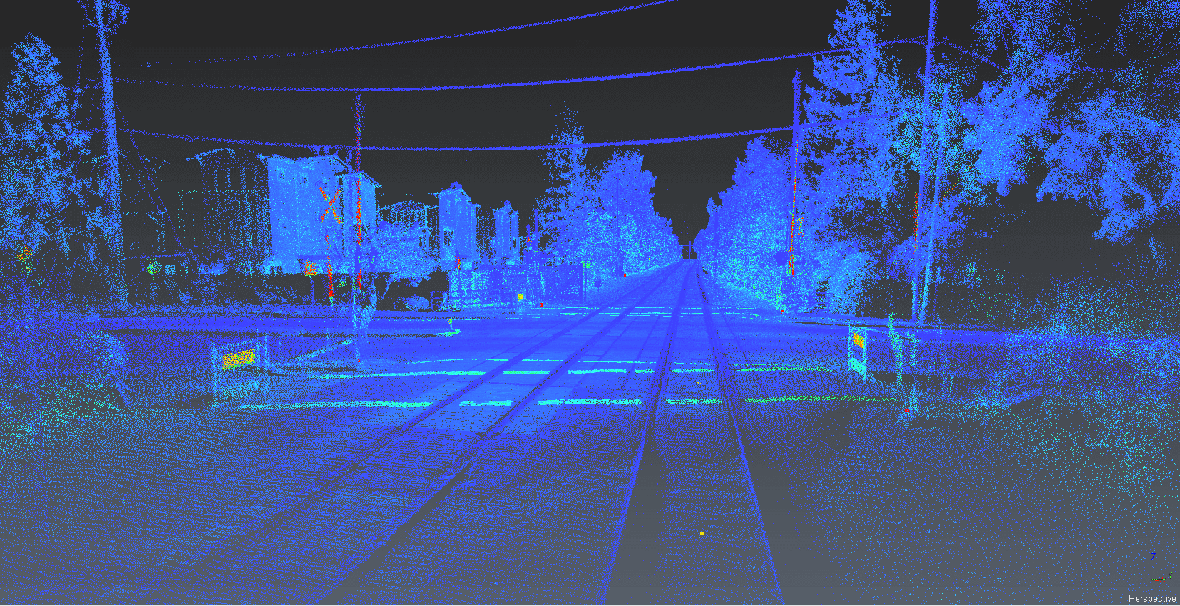
Railroad LiDAR Mapping
Mobile LiDAR Mapping Services
– Street Level LiDAR Survey
– Street Asset Mapping
– Flood Elevation Surveys
– Condition Assessment
– Smart City Mapping
– Parking Lot Surveys
– Rail Right of Way Mapping
– 3D Surface Imaging
– Track Geometry
– Horizontal Alignment
– PTC Asset Location
– Railroad 3D Imaging
Mobile LiDAR Mapping FAQs
Mobile LiDAR mapping for clients nationwide has become more affordable in recent years. While there are many questions about how it works, its benefits, data format, and how it is collected, we tried to cover the most frequently asked questions below. If you have more questions you would like us to answer, please send them to info@realityimt.com and we would be happy to answer them.
Please note, this page is not meant to address Airborne LiDAR, if you need info on Airborne LiDAR, you can visit ASPRS.
Q: What is Mobile LiDAR and what is it used for?

A: Mobile LiDAR is a method of collecting LiDAR data from a moving vehicle.
LiDAR stands for Light Detection and Ranging. It is an active remote sensing method that uses a laser to measure ranges (variable distances) to the surrounding environment. When the laser is combined with GPS and Inertial Navigation System (INS) data, a precise dimension, shape, and location on Earth are generated in 3D.
Mobile LiDAR is used to map and survey corridors from the street level with high accuracy. Roads, highways, and railways can be mapped at high speed without disturbing traffic.
Q: What are the benefits of Mobile LiDAR?

A: The benefits of mobile LiDAR include:
- High-density, high-accuracy geospatial data
- the Ideal solution for extracting street features as lines, polygons, or points.
- Cost-effective on linear projects
- Provide rapid documentation of existing conditions.
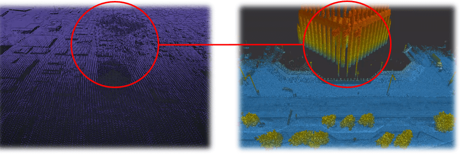
Q: What is the difference between Aerial LiDAR and Mobile LiDAR?

A: Aerial LiDAR versus Street Level LiDAR
Aerial LiDAR |
Street Level LiDAR |
|
|
Q: What type of data is produced by Vehicle based LiDAR?
A: Vehicle-Based LiDAR produces Pointcloud Data
In surveying and mapping, mobile LiDAR data is always geo-referenced to either a local or a global coordinate system. The most common pointcloud data formats from mobile lidar include LAS, LAZ, and XYZ.
Request a Proposal
Don't hesitate to contact us
2700 Post Oak Blvd 21st Floor
Houston, TX 77056, USA
Phone: +1 713-636-9844
Email: info@realityimt.com