LiDAR Analytics-Geospatial Mapping from Reality IMT
It’s Not About the Type of Data You Collect, or How You Collect It. It’s About What You Can Do With It.
While there are different methods and tools used to collect geospatial data, it boils down to how to purposely use this data to support your project. Our geospatial data and LiDAR analytics team has more than a decade of experience in analyzing data and generating accurate reports. We analyze data collected from GPS, Mobile LiDAR, Terrestrial Laser Scanners, GIS Collectors, Aerial Imagery, Photogrammetry, and Videos to help produce the results you are seeking.
In any LiDAR analytics or geospatial mapping project nationwide, the first step is to establish a baseline. The measurements are collected over a specified period of time (depending on the required analysis), then analyzed against the baseline to locate anomalies in the structure.
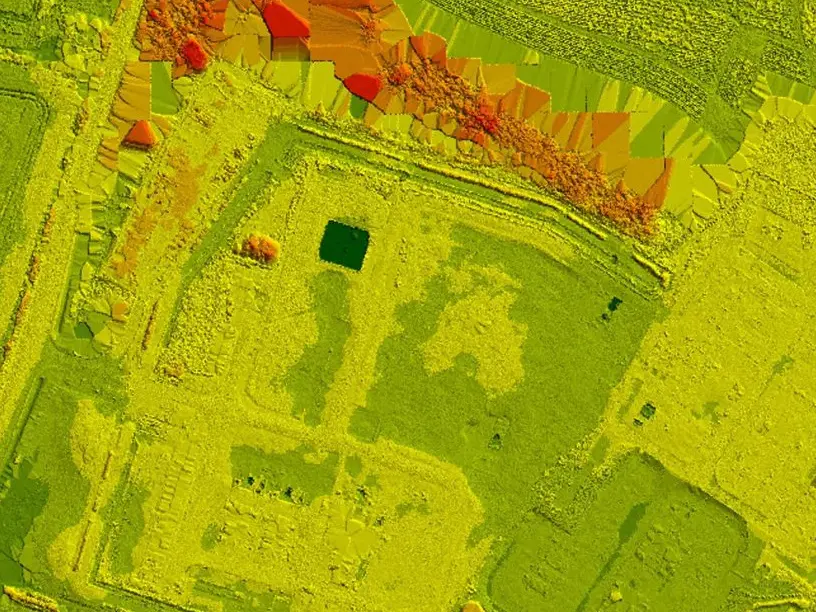
Deformation Analysis
")
Do you need to identify surface deformation in a structure?
With combined structural engineering & geospatial analytics expertise, our geospatial mapping professionals perform accurate condition assessments on structures. Deformation analysis is mainly about acquiring, processing, and analyzing accurate data. Using state-of-the-art 3D data collectors such as 3D laser scanners, LiDAR, precision GPS, etc. we are able to collect engineering-grade measurements of any existing structure. Depending on your project requirements, deformation analysis can be delivered in a 3D format including LAS, LAZ, glTF, STL, OBJ, DXF, DWG, GIS, or 3D PDF.
Impervious Surface Calculations
")
Do you have a large site that needs impervious surface calculations?
Instead of using conventional methods, Reality IMT deploys 3D mapping and imaging technology that can map out your site in minutes. The data is then taken to our office for processing where a geo-referenced 3D CAD file or GIS is created. Within a few days, you will receive a comprehensive report showing the location and quantity of the impervious surfaces. We work closely with surveyors to ensure that we are using the most recent survey control in the vicinity. This also helps your surveyor perform quality checks to ensure that data is accurate enough for your project.
Volumetric Calculations

Stockpiles, Vessels, Tanks, and Structures
Depending on the type of project, Reality IMT has the right expertise and tools to get you accurate volumetric calculations from our. We work closely with your team to identify project requirements, deliverables, frequency, and schedule, then assign the right resources needed to handle your project. Do you have a complex structure that requires volumetric? We are used to working with complex geometric shapes and would be happy to assist you with your volumetric calculations.