The Challenge
As part of a federal mandate passed by Congress in 2008, the MBTA is installing Positive Train Control (PTC) technology across all Commuter Rail lines. PTC can automatically reduce a train’s speed or even stop it to avoid a collision or derailment. It will improve safety and reduce human error on the commuter rail. Establishing a wide communication system throughout the entire commuter rail network of almost 1200 miles is no easy task. Fiber optic cables will need to be installed along the tracks Right of Way (ROW), without disrupting the rail’s movement. Field conditions, existing utility locations, and access points must be known before any contractor can bid on the project. If someone chose to walk the tracks, it would take 20 days to walk 100 miles. If someone chooses to drive the tracks with a basic camera, it could not provide the full picture of the right of way. This led to valuable Signal and PTC Engineers working 60 to 70 hours a week and not being able to get the rest of their work done. This was also a very costly endeavor as the average PTC Engineer makes $114,605 a year, which meant that it costs the city $11,460 a month per engineer just to survey and map out the tracks.
The Solution
Dagle Electric Construction was the company responsible for the fiber optics project and they decided to team up with Reality IMT to reduce costs, improve efficiencies, and provide engineering-grade data to the PTC and Signal Engineers without anyone leaving their office. They decided to lease the camera system (Omni-directional camera, mobile workstation, RTK GPS with Inertial Measurement Unit and a desktop workstation) for the duration of the project. Reality IMT then delivered, mounted, and trained their team on how to record data (Setting up the system on a high rail vehicle takes 15 minutes and training takes less than 2 hours). Reality IMT then mapped out 50 miles of rail each day versus 5 miles a day. Reality IMT then processed all the data remotely by logging in to the desktop workstation once
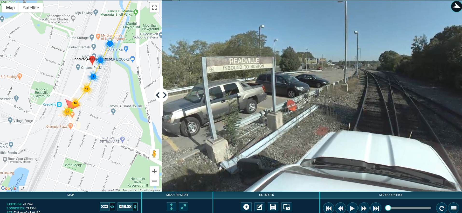
the data came back from the field. The PTC and Signal Engineers along with all project stakeholders could then use the data to tag assets from the office as easy as dropping a pin in the image, naming it and this pin will automatically be shown on the map with its GPS coordinates.
The Result
The project was a resounding success. All project stakeholders can now access visual information on the MTBA-ROW using OcuMap without leaving their office. The PTC Engineers and Signal Engineers can now focus their time and energy on higher value tasks such as implementing projects to maintain, fix, and add to their railway lines. According to our client “Before using OcuMap, we had to pull up CAD files, then open google earth, then look at images that came in from the field using someone’s phone, and could not make a decision on how to deploy our equipment, with OcuMap enabled us to sit in a conference room physically or virtually, and look at site conditions, see where we were looking on the map and make immediate decisions about deploying field resources.” The most conservative estimate we received from our client is that our service saved them 80% on costs and increased their efficiency by 60%.


