Category: General

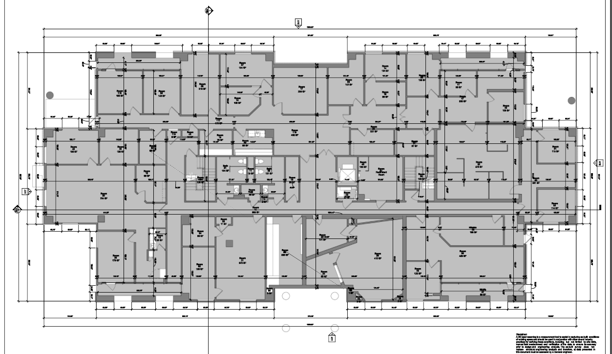
Accurate and Fast Floor Plan Measurements using 3D Building Scanning Technology
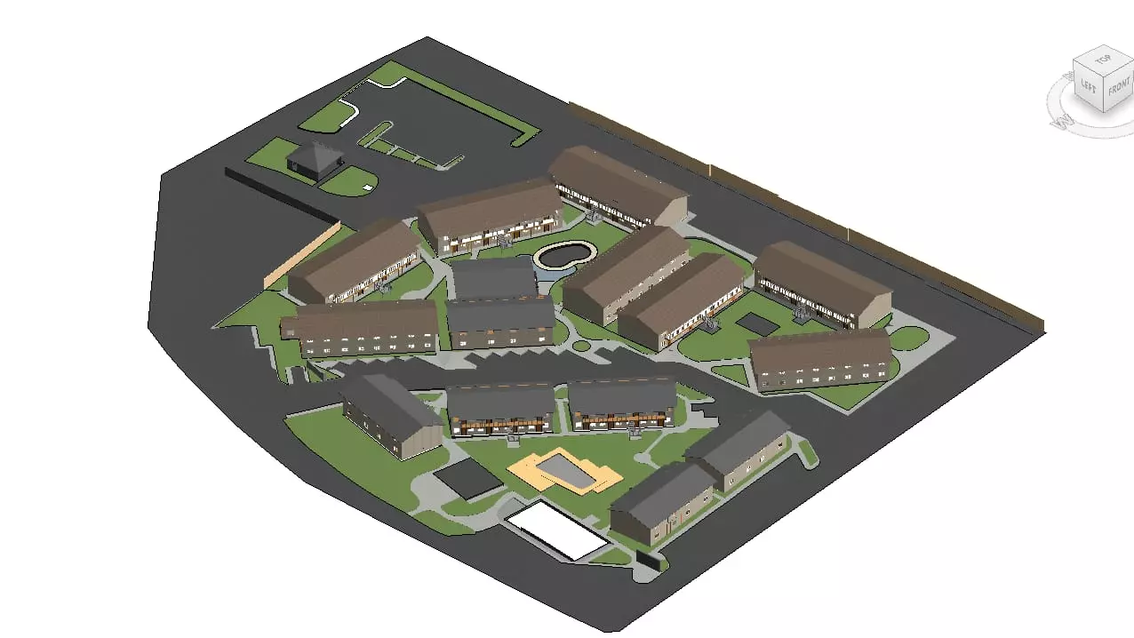
Use 3D scanning to generate accurate BIMs before your next multi-family renovation
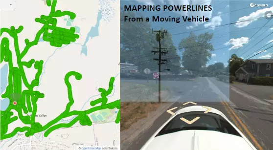
Drive-By-Imagery to help you locate and assess your powerline network
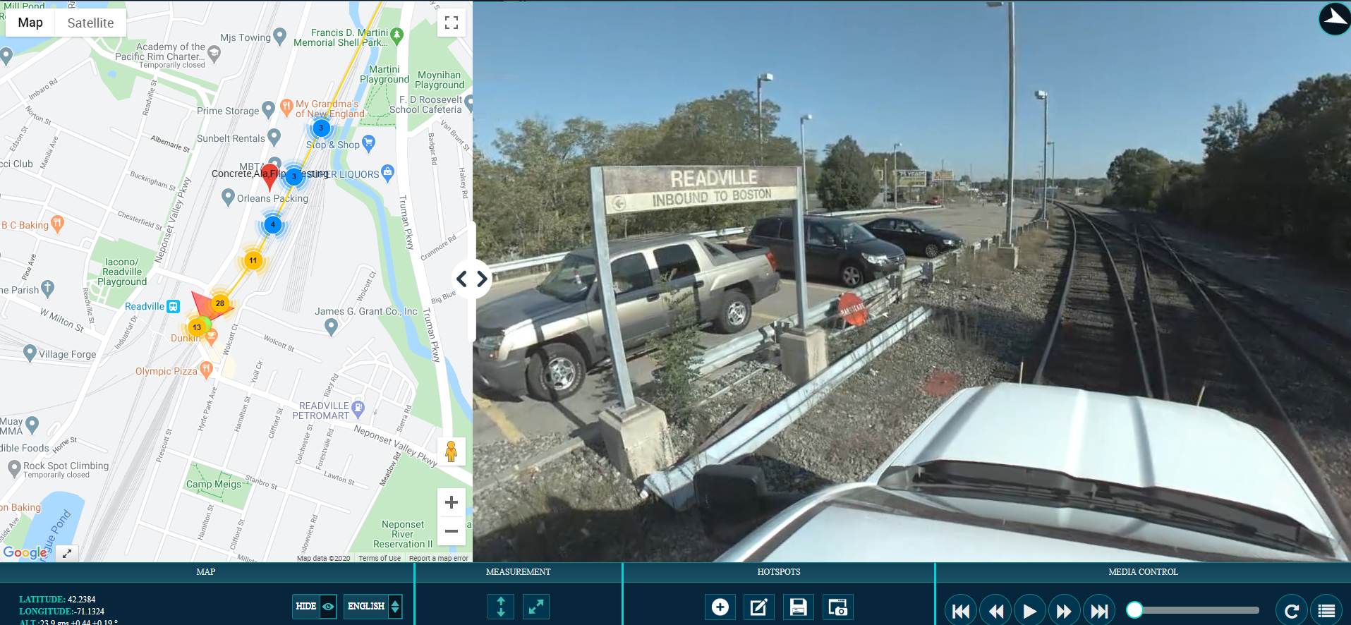
MBTA Line Survey
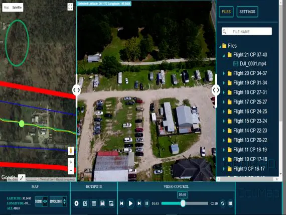
GEOVIDEO-AN ALTERNATIVE TO PHOTOGRAMMETRY
Geovideo-The Challenge As one of the nation’s largest cities (4th in population, 9th in land area), Houston’s drainage network extends over an area of nearly 2500 square kilometers. This area is difficult and time-consuming to inspect, therefore expensive to do...