
ENTERPRISE REALITY CAPTURE & EXISTING CONDITIONS
3D Laser Scanning Services for Accurate Existing-Condition Documentation
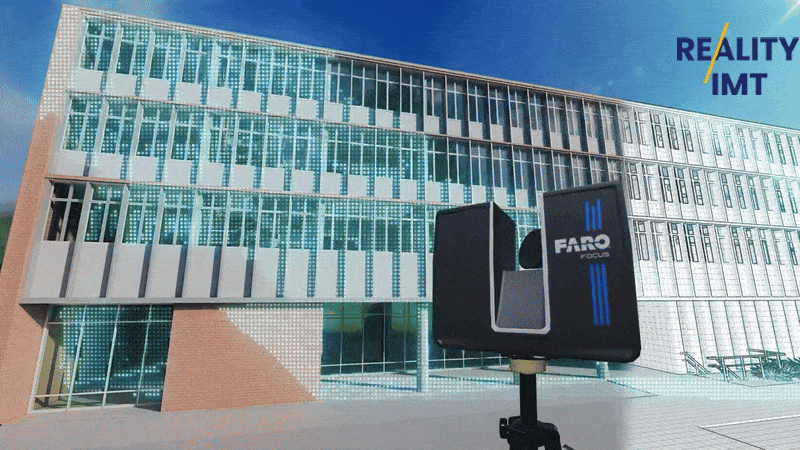
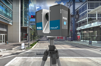
Reality IMT provides nationwide 3D laser scanning services for architects, engineers, contractors, owners, and facility managers. Using high-accuracy terrestrial laser scanners, we capture existing building and site conditions and convert them into point clouds, floor plans, as-built drawings, CAD documentation, and BIM-ready deliverables for renovation, design, construction, and facility management projects.
What This Service Includes
3D laser scanning captures millions of measurements in seconds to create a highly accurate digital representation of existing conditions. The resulting point cloud serves as the foundation for building documentation, as-built drawings, CAD production, BIM modeling, facility planning, renovation design, construction verification, and long-term asset management.
Who Uses This Service
Architects & Engineers
Existing-condition documentation for renovations, additions, adaptive reuse, BIM coordination, and design development.
Owners & Facility Teams
Facility records, capital planning, maintenance programs, space management, and building lifecycle documentation.
Contractors
Construction verification, clash detection, renovation planning, quantity verification, and field coordination.
Industrial / CRE / Public Sector
Commercial buildings, industrial facilities, healthcare campuses, educational institutions, airports, utilities, and government projects.
Common Use Cases
Renovation & Retrofit Planning
Capture accurate existing conditions before renovations, tenant improvements, expansions, or modernization projects.
Existing-Condition Verification
Replace missing, outdated, or unreliable drawings with verified field documentation.
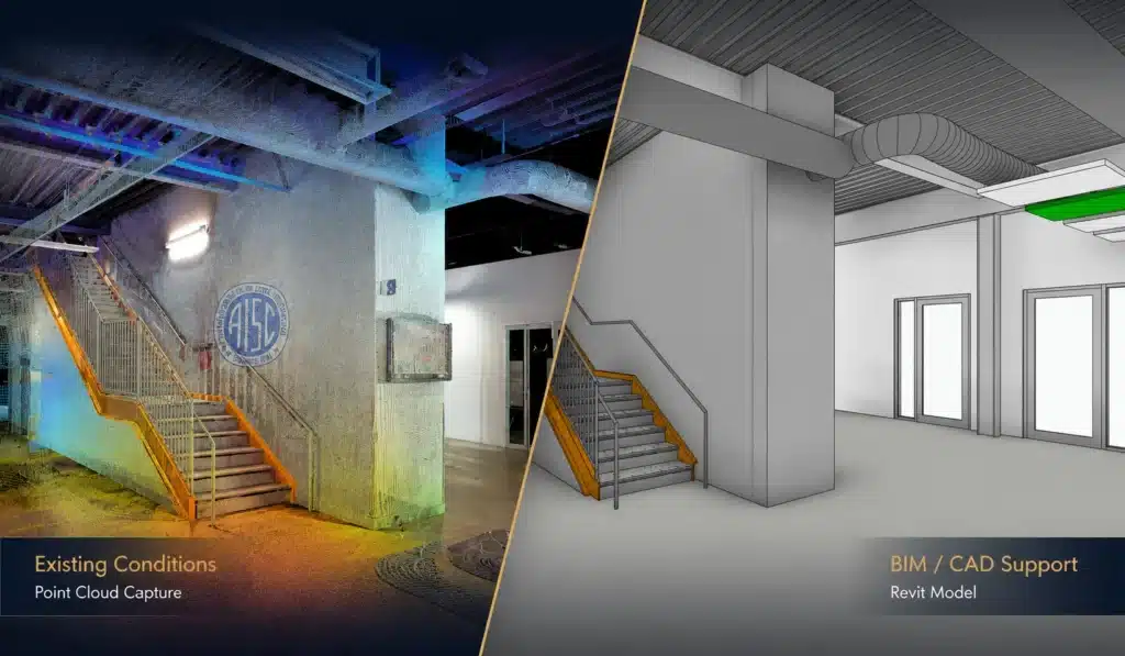
Design / BIM / CAD Supportv
Generate point clouds, floor plans, CAD drawings, and Revit models to support design and engineering workflows.
Deliverables
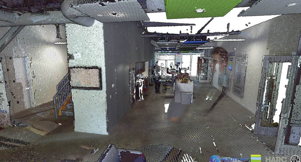
Point Cloud
High-density reality capture data for measurements, coordination, verification, and future project reference.
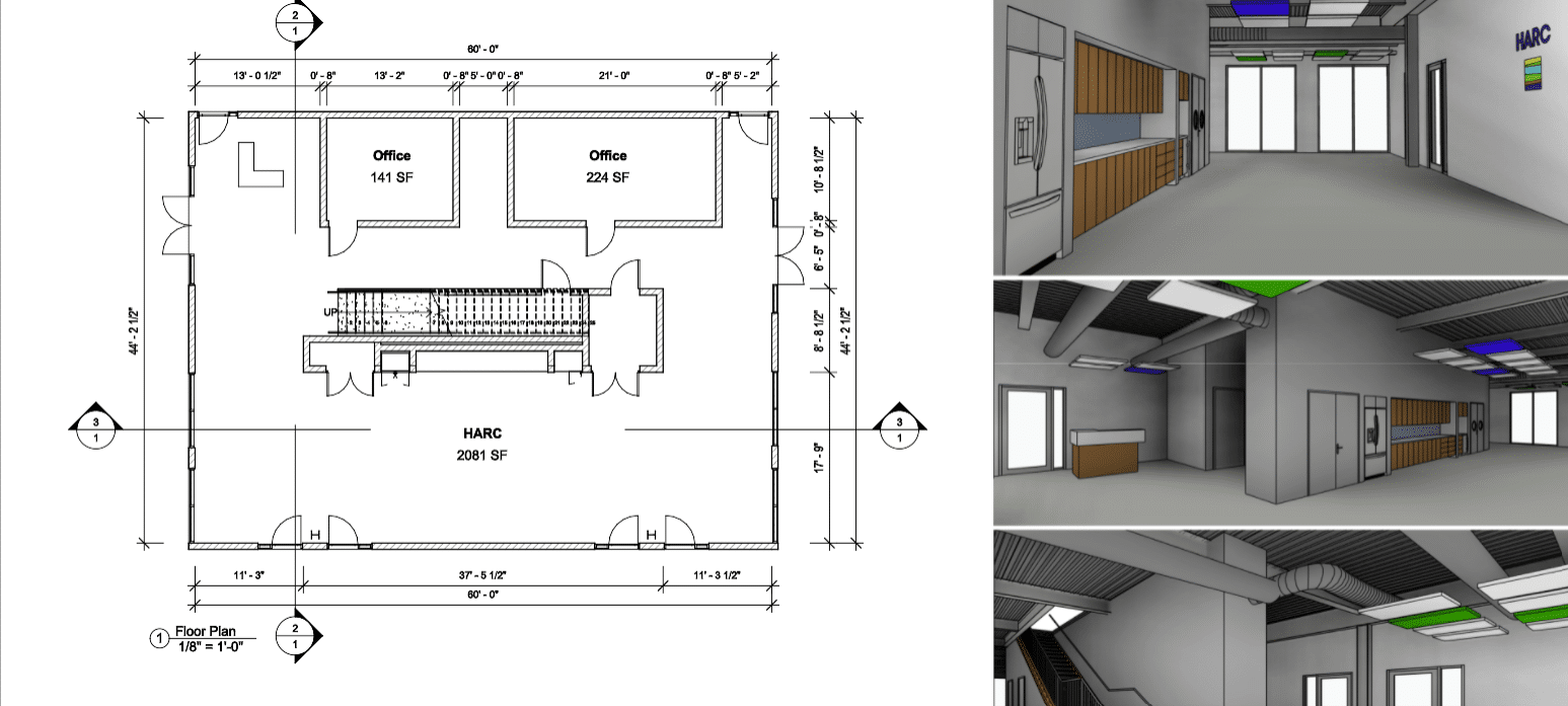
CAD / DWG Drawings
As-built floor plans, reflected ceiling plans, elevations, sections, and documentation packages.
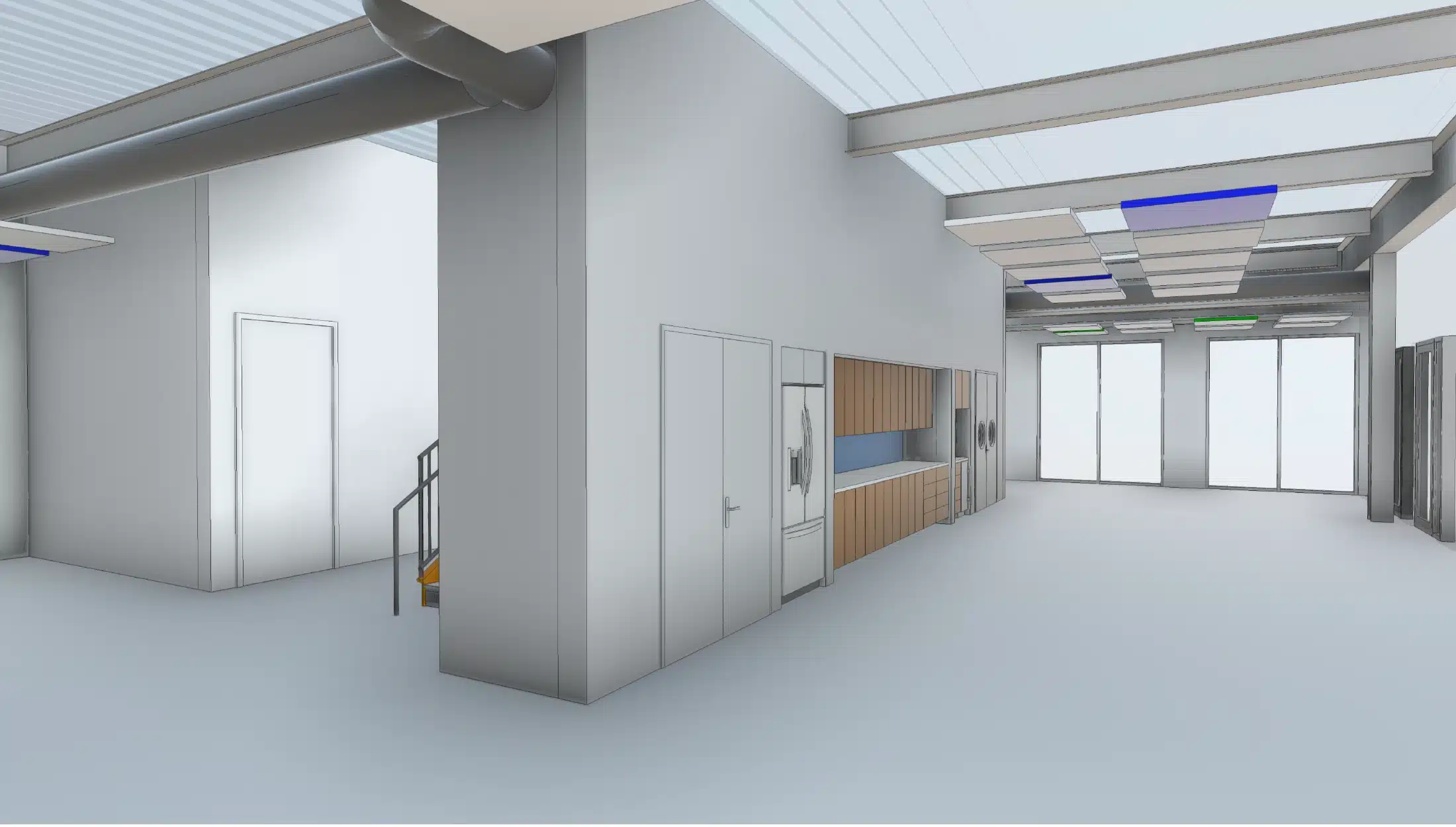
Revit / BIM Model
LOD-based BIM models supporting design coordination, facility management, and renovation planning.
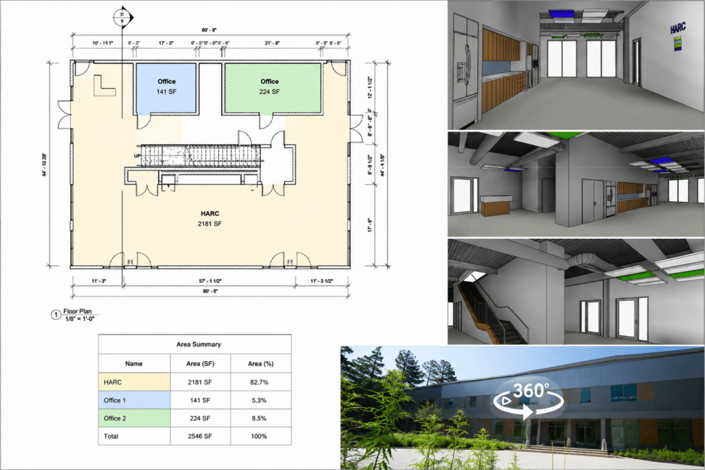
Floor Plans / Reports
Existing-condition floor plans, building documentation, area verification, and project reports.
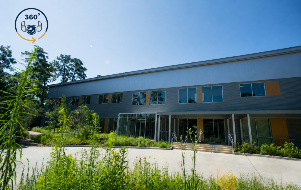
360 Visual References
Immersive visual documentation supporting design review, facility management, and remote collaboration.
Our Process
1. Scope
Review project goals, building access requirements, deliverables, schedule, and accuracy requirements.
2. Capture & Process
Perform field scanning, register point clouds, verify data quality, and prepare deliverable production workflows.
3. Deliver
Provide point clouds, CAD drawings, Revit models, floor plans, reports, and approved project deliverables.
FAQs
What is 3D Laser Scanning and what is it used for?
3D laser scanning is a method used to measure dimensions and geometry of existing structures with high accuracy. The instrument used to measure dimensions is called a 3D laser scanner. 3D laser scanning is used to replicate real life objects needed to deliver an as-is or an as-built survey for further engineering analysis.
What are the benefits of a 3D Laser Scanning survey?
When compared to conventional measurements methods, a 3D laser scan survey provides millions and sometimes trillions of surface measurements in 3D, making it a much more detailed survey. See more applications here
How much does a 3D Laser Scan survey cost?
Pricing a 3D laser scan survey depends on the area being scanned and the level of details needed. The larger the area, the more scans will be needed to cover it. It also depends on how many walls or obstructions are in the vicinity, the more obstructions, the longer the survey will take and the more it will cost. Another factor is whether or not colored scans are needed. Colored scans take longer to capture and cost more but provide better visuals.
What 3D Scanner should I use to scan the exterior and interior of a structure?
Almost all professional grade laser scanners can operate indoor and outdoor. One important factor to consider when selecting a 3D laser scanner is range. If you need to scan tall structure, determine the maximum height you will be dealing with then multiple it by 3 to help you decide on the scanning range. Another factor to consider is accuracy or ranging error. This is a number provided by the manufacture showing the + and – tolerances.
Is 3D Laser Scanning suitable for a topographic surveys?
Yes, the amount of data measurements collected by a 3D laser scanner makes it an ideal solution for a topographic survey as it logs the x,y,z values of every inch in the surrounding area. A survey control point will be needed to tie in the laser data to a datum.
What software is used in 3D Laser Scanning?
Depending on the type of scanner used, each manufacturer has their own software that is compatible with the laser data (point cloud). Pointcloud registration software include Scene, Cyclone and Recap. Once the point cloud data is registered, it can be imported into many different software tools depending on the project needs.
What is the cost of a 3D Laser Scanner?
Professional grade 3D laser scanners range between $25K to $90K depending on accuracy, manufacturer, and use case.
Can I create a BIM using a 3D Laser Scanner?
Yes, the process for creating a building information model (BIM) using our 3D laser scanner includes: scanning the building, registering the point cloud data, converting the point cloud data into an RCP/RCS format, then importing RCP/RCS into Revit for modeling. It is important to point out that the scanner in itself does not provide a ready to use BIM. Our team will use an an architectural modeler to create Revit families and add any relevant information to the model manually.
Need 3D laser scanning for your project?
Share your project location, approximate size, timeline, and required deliverables. We’ll recommend the right laser scanning workflow and provide the point cloud, CAD, floor plan, Revit, or documentation package your team needs.